 |
This is a file from the Wikimedia Commons. Information from its description page there is shown below.
Commons is a freely licensed media file repository. You can help.
|
Summary
| Description |
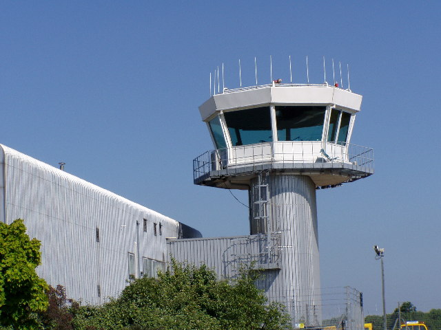
English: Southampton Airport Control Tower. Southampton Airport
|
| Date |
July 2005 |
| Source |
From geograph.org.uk |
| Author |
Roy Gray |
|
Camera location
|
50° 56′ 55.96″ N, 1° 21′ 33.71″ W
|
This and other images at their locations on: Google Maps - Google Earth - OpenStreetMap |
( Info)50.948878;-1.359365 |
Licensing
 |
This image was taken from the Geograph project collection. See this photograph's page on the Geograph website for the photographer's contact details. The copyright on this image is owned by Roy Gray and is licensed for reuse under the Creative Commons Attribution-ShareAlike 2.0 license. |
 The categories of this image should be checked. Check them now!
- Remove redundant categories and try to put this image in the most specific category/categories
- Remove this template
- The location categories are based on information from this geonames tool and this OpenStreetMap tool combined with a database. You can also have a look at this tool from mysociety.
- The topic category from Geograph was Airport (find similar images at Geograph)
This image was uploaded as part of the Geograph batch upload
File usage
The following pages on Schools Wikipedia link to this image (list may be incomplete):
This file contains additional information, probably added from the digital camera or scanner used to create or digitize it. If the file has been modified from its original state, some details may not fully reflect the modified file.
Wikipedia for Schools was collected by SOS Children. SOS Children's Villages is a global charity founded in 1949 to give children who have lost everything the childhood they deserve. Have you heard about child sponsorship? Visit our web site to find out.


