 |
This is a file from the Wikimedia Commons. Information from its description page there is shown below.
Commons is a freely licensed media file repository. You can help.
|
| Description |
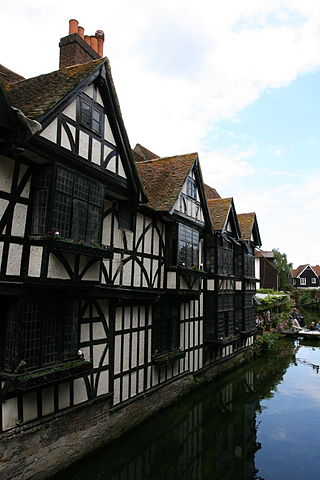
The River Stour flowing through Canterbury |
| Date |
15 June 2008, 15:42 |
| Source |
River Stour |
| Author |
Chris Brown |
|
Camera location
|
51° 16′ 47.15″ N, 1° 4′ 44.07″ E
|
This and other images at their locations on: Google Maps - Google Earth - OpenStreetMap |
( Info)51.279763;1.078907 |
Licensing

 |
This file is licensed under the Creative Commons Attribution 2.0 Generic license. |
|
|
|
- You are free:
- to share – to copy, distribute and transmit the work
- to remix – to adapt the work
- Under the following conditions:
- attribution – You must attribute the work in the manner specified by the author or licensor (but not in any way that suggests that they endorse you or your use of the work).
http://creativecommons.org/licenses/by/2.0 CC-BY-2.0 Creative Commons Attribution 2.0 truetrue
|
 |
This image was originally posted to Flickr by zoonabar at http://flickr.com/photos/92496717@N00/2581690160. It was reviewed on 1 August 2009 by the FlickreviewR robot and was confirmed to be licensed under the terms of the cc-by-2.0. |
This file contains additional information, probably added from the digital camera or scanner used to create or digitize it. If the file has been modified from its original state, some details may not fully reflect the modified file.
Wikipedia for Schools was collected by SOS Children's Villages. SOS Childrens Villages helps those who have nothing and no one, giving them back the famly they have lost and bringing them the very best opportunities for a happy, healthy future. Will you help another child today?


