
File:Edinburgh map.png
Size of this preview: 614 × 479 pixels.
| |
This is a file from the Wikimedia Commons. Information from its description page there is shown below.
Commons is a freely licensed media file repository. You can help. |
 |
This map image could be recreated using vector graphics as an SVG file. This has several advantages; see Commons:Media for cleanup for more information. If an SVG form of this image is already available, please upload it. After uploading an SVG, replace this template with {{ vector version available|new image name.svg}}. |
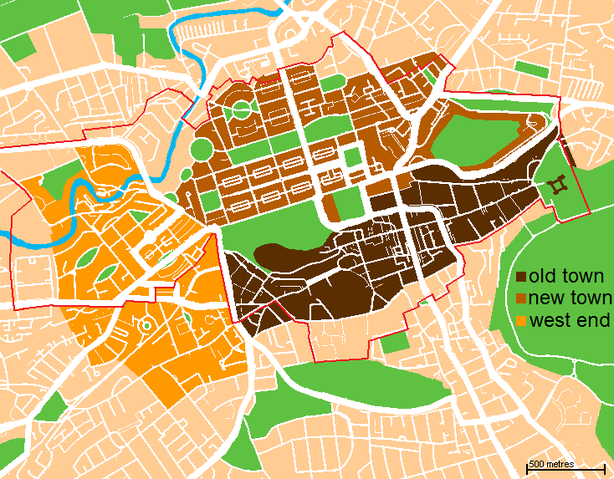
| Description | A map of the city centre of Edinburgh, Scotland. Old Town is in dark brown, New Town in light brown, West End is in yellow, and the World Heritage Site boundary is the red line. | ||
| Date | 01:19, 16 November 2007 (UTC) | ||
| Source | Based loosely on http://www.aboutscotland.com/edin/newtown.html, updated based on the 'Edinburgh Navigator' maps. | ||
| Author | Jack · talk · | ||
| Permission ( Reusing this file) |
|
 |
I, the copyright holder of this work, release this work into the public domain. This applies worldwide. In some countries this may not be legally possible; if so: I grant anyone the right to use this work for any purpose, without any conditions, unless such conditions are required by law.
|
File usage
The following pages on Schools Wikipedia link to this image (list may be incomplete):
Metadata
Did you know...?
SOS Children's Villages chose the best bits of Wikipedia to help you learn. SOS Children's Villages cares for children who have lost their parents. Our Children's Villages give these children a new home and a new family, while a high-quality education and the best of medical care ensures they will grow up with all they need to succeed in adult life. Why not try to learn more about child sponsorship?