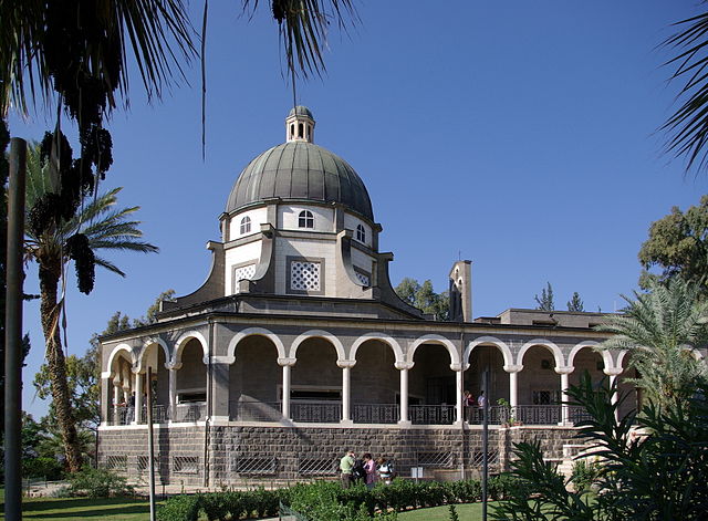
File:Berg der Seligpreisungen BW 1.JPG

Size of this preview: 640 × 471 pixels.
| |
This is a file from the Wikimedia Commons. Information from its description page there is shown below.
Commons is a freely licensed media file repository. You can help. |
Summary
|
Camera location |
32° 52′ 50.72″ N, 35° 33′ 22.61″ E |
View this and other nearby images on: Google Maps - Google Earth - OpenStreetMap | ( Info)32.880755555556;35.556280555556 |
|---|
| DescriptionBerg der Seligpreisungen BW 1.JPG |
Deutsch: Kirche auf dem Berg der Seligpreisungen
English: Church on the Mount of Beatitudes, in Israel.
Français : Eglise sur le mont des béatitudes, en Israël.
|
| Date | 5 November 2008 |
| Source | Own work |
| Author | Berthold Werner |
Licensing
| Public domainPublic domainfalsefalse |
 |
I, the copyright holder of this work, release this work into the public domain. This applies worldwide. In some countries this may not be legally possible; if so: I grant anyone the right to use this work for any purpose, without any conditions, unless such conditions are required by law. Public domainPublic domainfalsefalse |
 |
This image has been assessed under the valued image criteria and is considered the most valued image on Commons within the scope: Church of the Beatitudes, Galilee. You can see its nomination at Commons:Valued image candidates/Berg der Seligpreisungen BW 1.JPG.
|
File usage
The following pages on Schools Wikipedia link to this image (list may be incomplete):
Metadata
This file contains additional information, probably added from the digital camera or scanner used to create or digitize it. If the file has been modified from its original state, some details may not fully reflect the modified file.
| Camera manufacturer | PENTAX Corporation |
|---|---|
| Camera model | PENTAX K10D |
| Author | Berthold Werner |
| Copyright holder | Public Domain |
| Exposure time | 1/350 sec (0.0028571428571429) |
| F-number | f/6.7 |
| ISO speed rating | 100 |
| Date and time of data generation | 07:45, 5 November 2008 |
| Lens focal length | 18 mm |
| Latitude | 32° 52′ 50.72″ N |
| Longitude | 35° 33′ 22.61″ E |
| Altitude | 8,086 meters below sea level |
| Orientation | Normal |
| Horizontal resolution | 96 dpi |
| Vertical resolution | 96 dpi |
| Software used | K10D Ver 1.30 |
| File change date and time | 07:45, 5 November 2008 |
| Y and C positioning | Co-sited |
| Exposure Program | Normal program |
| Exif version | 2.21 |
| Date and time of digitizing | 07:45, 5 November 2008 |
| Meaning of each component |
|
| Exposure bias | 0 |
| Metering mode | Pattern |
| Flash | Flash did not fire, compulsory flash suppression |
| Supported Flashpix version | 0,100 |
| Colour space | sRGB |
| Sensing method | One-chip colour area sensor |
| File source | Digital still camera |
| Scene type | A directly photographed image |
| Custom image processing | Normal process |
| Exposure mode | Auto exposure |
| White balance | Auto white balance |
| Focal length in 35 mm film | 27 mm |
| Scene capture type | Standard |
| Contrast | Normal |
| Saturation | Normal |
| Sharpness | Hard |
| Subject distance range | Distant view |
Schools Wikipedia and SOS Children
Schools Wikipedia was created by children's charity SOS Children. SOS Children is there for the children in our care until they are ready for independence. Have you thought about sponsoring a child?
