 |
This is a file from the Wikimedia Commons. Information from its description page there is shown below.
Commons is a freely licensed media file repository. You can help.
|
Summary
| Description |
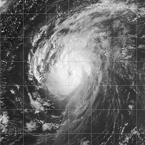
This image of Hurricane Danielle was captured by the GOES-12 satellite on August 16, 2004 at 1815 UTC. Danielle was located in the Atlantic Ocean with peak winds of 110 mph and a minimum pressure of 964 mb. |
| Date |
16 August 2004 |
| Source |
http://www.nrlmry.navy.mil/tc_pages/tc_home.html |
| Author |
Naval Research Laboratory |
Permission
( Reusing this file) |
| Public domainPublic domainfalsefalse |
 |
This file is a work of a sailor or employee of the U.S. Navy, taken or made as part of that person's official duties. As a work of the U.S. federal government, the image is in the public domain. |
|
|
This file has been identified as being free of known restrictions under copyright law, including all related and neighboring rights.
|
|
File usage
The following pages on Schools Wikipedia link to this image (list may be incomplete):
Schools Wikipedia was launched to make learning available to everyone. More than 2 million people benefit from the global charity work of SOS Childrens Villages, and our work in 133 countries around the world is vital to ensuring a better future for vulnerable children. Help another child by taking out a sponsorship.


