 |
This is a file from the Wikimedia Commons. Information from its description page there is shown below.
Commons is a freely licensed media file repository. You can help.
|
Summary
| DescriptionPakistan Nationalhighways.PNG |
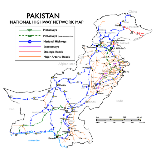
English: National Highways, Motorways & Strategic Roads in Pakistan. (Longest route N-5, from Karachi to Torkham, covering cities of Hyderabad, Multan, Lahore, Rawalpindi and Peshawar with a total length of 1,756 kilometers.)
Русский: Схема национальных автодорог, автомагистралей и стратегических дорог Пакистана
|
| Date |
Uploaded in June 2009 by Nomi887; modified in July 2009 by Brainlara73. |
| Source |
The English language Wikipedia. Original text: Self made using and as reference. |
| Author |
Original text: nomi887 ( talk) |
Permission
( Reusing this file) |
See below.
|
Licensing
File usage
The following pages on Schools Wikipedia link to this image (list may be incomplete):
This file contains additional information, probably added from the digital camera or scanner used to create or digitize it. If the file has been modified from its original state, some details may not fully reflect the modified file.
Schools Wikipedia was launched to make learning available to everyone. SOS Childrens Villages helps more than 2 million people across 133 countries around the world. Have you heard about child sponsorship? Visit our web site to find out.


