 |
This is a file from the Wikimedia Commons. Information from its description page there is shown below.
Commons is a freely licensed media file repository. You can help.
|
Summary
| DescriptionView from Hardley Windpump - geograph.org.uk - 2037603.jpg |
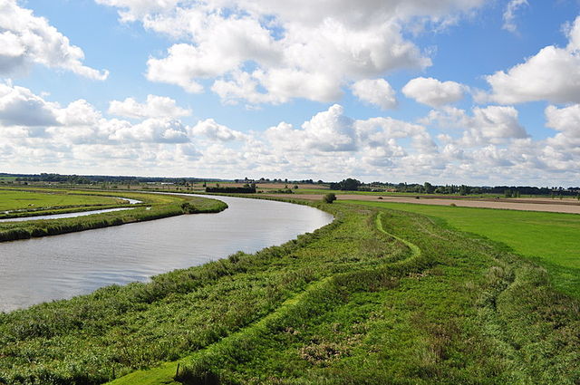
English: View from Hardley Windpump, near to Hardley Street, Norfolk, Great Britain. See also http://www.geograph.org.uk/photo/467516">SP0937 : Broadway High Street. The River Yare can be seen at at meander nearing the junction with the Chet. I didn't know it but there was once a drainage complex here, an earlier mill was sited between the little tree and the conifers. If you took an opposite look towards Cantley then you would be looking at the site of another now demolished mill and steam pumping station. Rather oddly this mill replaced the steam engine!
The path if the Wherryman's Way.
|
| Date |
28 August 2010 |
| Source |
From geograph.org.uk; transferred by User:Rubberstamp using geograph_org2commons. |
| Author |
Ashley Dace |
Permission
( Reusing this file) |
Creative Commons Attribution Share-alike license 2.0
|
|
Camera location
|
52° 34′ 4.07″ N, 1° 31′ 18.08″ E
|
View this and other nearby images on: Google Maps - Google Earth - OpenStreetMap |
( Info)52.567797;1.521688 |
Licensing
 |
This image was taken from the Geograph project collection. See this photograph's page on the Geograph website for the photographer's contact details. The copyright on this image is owned by Ashley Dace and is licensed for reuse under the Creative Commons Attribution-ShareAlike 2.0 license. |
File usage
The following pages on Schools Wikipedia link to this image (list may be incomplete):
SOS Children's Villages has brought Wikipedia to the classroom. SOS Children believes that a decent childhood is essential to a happy, healthy. Our community work brings families new opportunities through education, healthcare and all manner of support. You can help by sponsoring a child.


