 |
This is a file from the Wikimedia Commons. Information from its description page there is shown below.
Commons is a freely licensed media file repository. You can help.
|
| DescriptionUruguay T2.png |
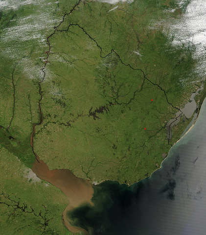
Español: Foto de Uruguay tomada desde satélite. Se aprecian claramente los límites con Brasil y Argentina, y el Río de la Plata al sur.
|
| Date |
21 December 2002 |
| Source |
http://visibleearth.nasa.gov/view_rec.php?id=4817 |
| Author |
Jeff Schmaltz, MODIS Rapid Response Team, NASA/GSFC |
Licensing
| Public domainPublic domainfalsefalse |
 |
This file is in the public domain because it was solely created by NASA. NASA copyright policy states that "NASA material is not protected by copyright unless noted". (See Template:PD-USGov, NASA copyright policy page or JPL Image Use Policy.) |
|
|
|
Warnings:
- Use of NASA logos, insignia and emblems are restricted per US law 14 CFR 1221.
- The NASA website hosts a large number of images from the Soviet/ Russian space agency, and other non-American space agencies. These are not necessarily in the public domain.
- Materials based on Hubble Space Telescope data may be copyrighted if they are not explicitly produced by the STScI. See also {{ PD-Hubble}} and {{ Cc-Hubble}}.
- The SOHO (ESA & NASA) joint project implies that all materials created by its probe are copyrighted and require permission for commercial non-educational use.
- Images featured on the Astronomy Picture of the Day (APOD) web site may be copyrighted.
|
File usage
The following pages on Schools Wikipedia link to this image (list may be incomplete):
Schools Wikipedia was created by children's charity SOS Children's Villages. SOS Childrens Villages helps those who have nothing and no one, giving them back the famly they have lost and bringing them the very best opportunities for a happy, healthy future. Help another child by taking out a sponsorship.


