
File:2008 Zimbabwe Cholera Outbreak Combined.svg
Size of this preview: 617 × 480 pixels.
| |
This is a file from the Wikimedia Commons. Information from its description page there is shown below.
Commons is a freely licensed media file repository. You can help. |
Summary
| Description |
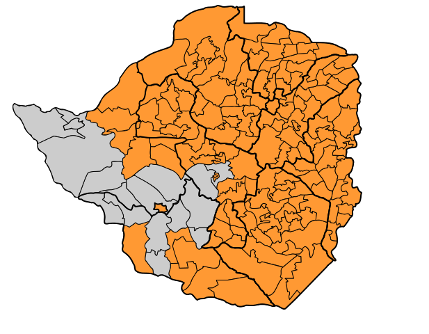
English: A map showing the spread of the 2008 Zimbabwe cholera outbreak (affected areas shown in orange) - combined evidence from United Nations Office for the Coordination of Humanitarian Affairs Alertnet and Relief Web. Primary Source:WHO
|
| Date | 2008/12/08 |
| Source | Own work |
| Author | Mangwanani |
| Permission ( Reusing this file) |
Own Work - free to use |
Licensing
 |
I, the copyright holder of this work, release this work into the public domain. This applies worldwide. In some countries this may not be legally possible; if so: I grant anyone the right to use this work for any purpose, without any conditions, unless such conditions are required by law.
|
File usage
The following pages on Schools Wikipedia link to this image (list may be incomplete):
Metadata
About Schools Wikipedia
SOS Children aims to make Wikipedia suitable for young learners. More than 2 million people benefit from the global charity work of SOS Children, and our work in 133 countries around the world is vital to ensuring a better future for vulnerable children. Help another child by taking out a sponsorship.