 |
This is a file from the Wikimedia Commons. Information from its description page there is shown below.
Commons is a freely licensed media file repository. You can help.
|
Summary
| Description |
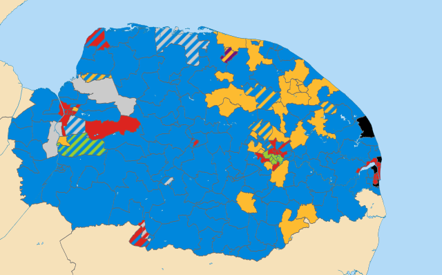
English: Results of all District, Borough and City Council elections held in May 2011.Colours:
Conservative
Liberal Democrat
Labour
Green
Independent (politician)
UKIP
Wards not being contested at these elections Striped wards have mixed representation.
|
| Date |
11 December 2012, 22:51:28 |
| Source |
Derived from File:Norfolk_UK_electoral_division_map_(blank).svg, created by Nilfanion using Ordnance Survey OpenData. |
| Author |
Woodgreener, derived from work by Nilfanion using Ordnance Survey OpenData |
Licensing
File usage
The following pages on Schools Wikipedia link to this image (list may be incomplete):
This file contains additional information, probably added from the digital camera or scanner used to create or digitize it. If the file has been modified from its original state, some details may not fully reflect the modified file.
SOS Childrens Villages aims to make Wikipedia suitable for young learners. In 133 nations around the world, SOS Childrens Villages works to bring better education and healthcare to families in desperate need of support. Will you help another child today?


