 |
This is a file from the Wikimedia Commons. Information from its description page there is shown below.
Commons is a freely licensed media file repository. You can help.
|
 |
This file was moved to Wikimedia Commons from en.wikipedia using a bot script. All source information is still present. It requires review. Additionally, there may be errors in any or all of the information fields; information on this file should not be considered reliable and the file should not be used until it has been reviewed and any needed corrections have been made. Once the review has been completed, this template should be removed. For details about this file, see below. Check now! |
| Description |
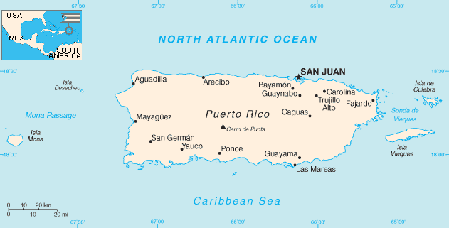
English: Map of Peuto Rico, with inset showing it's position in relation to American continents.
|
| Date |
2007-02-19 (first version); 2002-07-22 (last version) |
| Source |
Transferred from en.wikipedia; transferred to Commons by User:Sfan00_IMG using CommonsHelper. |
| Author |
Original uploader was Caltrop at en.wikipedia Later version(s) were uploaded by Hoshie, Ikescs, Hfastedge at en.wikipedia. |
Permission
( Reusing this file) |
PD-USGOV-CIA-WF.
|
License information
| Public domainPublic domainfalsefalse |
 |
This image is in the public domain because it contains materials that originally came from the United States Central Intelligence Agency's World Factbook.
|
|
File usage
The following pages on Schools Wikipedia link to this image (list may be incomplete):
Wikipedia for Schools was collected by SOS Childrens Villages. More than 2 million people benefit from the global charity work of SOS Children, and our work in 133 countries around the world is vital to ensuring a better future for vulnerable children. Have you thought about sponsoring a child?


