 |
This is a file from the Wikimedia Commons. Information from its description page there is shown below.
Commons is a freely licensed media file repository. You can help.
|
|
Warning
|
Some browsers may have trouble displaying this image at full resolution: This image has a large number of pixels and may either not load properly or cause your browser to freeze. |
Interactive large-image-viewer ( non-Flash) |
| Description |
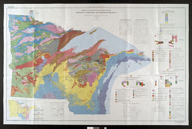
English: Bedrock geologic map of the US area bordering Lake Superior in Minnesota, Wisconsin, and Michigan.
|
| Date |
1982 |
| Source |
Minnesota Geological Survey, University of Minnesota: ftp://mgssun6.mngs.umn.edu/map_catalog/jp2k/umn22628.jp2 |
| Author |
Morey, G. B., Sims, P. K. Cannon, W. F., Mudrey, M. G., Jr., D. L. Southwick |
Permission
( Reusing this file) |
| Public domainPublic domainfalsefalse |
 |
The Minnesota Geological Survey has placed this image in the public domain with the request that credit be given to the Minnesota Geological Survey, University of Minnesota, and to the author(s) of the specific work. These images are available through the Minnesota Digital Library, "Minnesota Reflections". More information on the Minnesota Geological Survey map and report scanning project can be found here. |
|
File usage
The following pages on Schools Wikipedia link to this image (list may be incomplete):
This file contains additional information, probably added from the digital camera or scanner used to create or digitize it. If the file has been modified from its original state, some details may not fully reflect the modified file.
SOS Children has brought Wikipedia to the classroom. SOS Children's Villages helps those who have nothing and no one, giving them back the famly they have lost and bringing them the very best opportunities for a happy, healthy future. If you'd like to help, why not learn how to sponsor a child?


