
File:West Mansfield Friends Church.jpg
Size of this preview: 640 × 480 pixels.
| |
This is a file from the Wikimedia Commons. Information from its description page there is shown below.
Commons is a freely licensed media file repository. You can help. |
|
Camera location |
|
This and other images at their locations on: Google Maps - Google Earth - OpenStreetMap | ( Info) |
|---|
| Description |
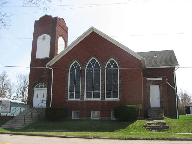
English: West Mansfield Friends Church, located on the southwestern corner of Centre (County Road 8) and Dean Streets in West Mansfield, Ohio, United States. It was built in 1912.
|
||
| Date | 5 April 2010 | ||
| Source | Own work | ||
| Author | Nyttend | ||
| Permission ( Reusing this file) |
|

File usage
The following pages on Schools Wikipedia link to this image (list may be incomplete):
Metadata
Did you know...?
Through Schools Wikipedia, SOS Children's Villages has brought learning to children around the world. In 133 nations around the world, SOS Children works to bring better education and healthcare to families in desperate need of support. Help another child by taking out a sponsorship.