 |
This is a file from the Wikimedia Commons. Information from its description page there is shown below.
Commons is a freely licensed media file repository. You can help.
|
Summary
| Description |
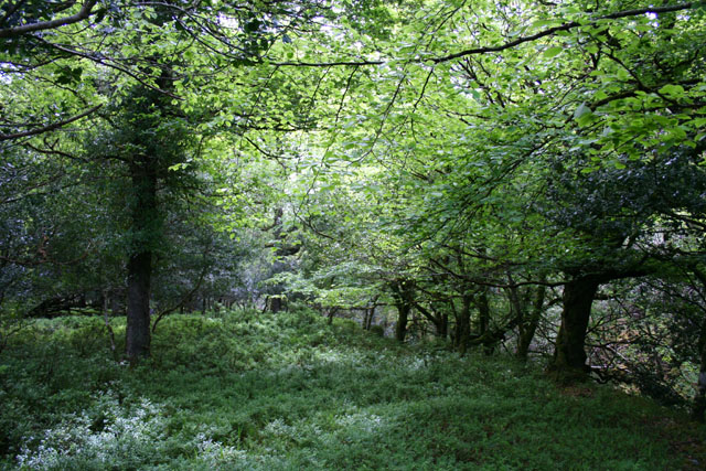
English: Deciduous woodland by the Owengarriff River Deciduous woodland, predominantly beech, between the Owengarriff River and the Old Kenmare Road (now on the Kerry Way footpath), south of Muckross Lake (Loch Mhucrois). The ground here is carpeted with wild garlic
|
| Date |
19 May 2007 |
| Source |
From geograph.org.uk |
| Author |
Espresso Addict |
|
Camera location
|
51° 59′ 52.14″ N, 9° 30′ 23.67″ W
|
This and other images at their locations on: Google Maps - Google Earth - OpenStreetMap |
( Info)51.997817;-9.506576 |
Licensing
 |
This image was taken from the Geograph project collection. See this photograph's page on the Geograph website for the photographer's contact details. The copyright on this image is owned by Espresso Addict and is licensed for reuse under the Creative Commons Attribution-ShareAlike 2.0 license. |
File usage
The following pages on Schools Wikipedia link to this image (list may be incomplete):
This file contains additional information, probably added from the digital camera or scanner used to create or digitize it. If the file has been modified from its original state, some details may not fully reflect the modified file.
Wikipedia for Schools brings Wikipedia into the classroom. SOS Childrens Villages helps those who have nothing and no one, giving them back the famly they have lost and bringing them the very best opportunities for a happy, healthy future. Why not try to find out more about sponsoring a child?


