 |
This is a file from the Wikimedia Commons. Information from its description page there is shown below.
Commons is a freely licensed media file repository. You can help.
|
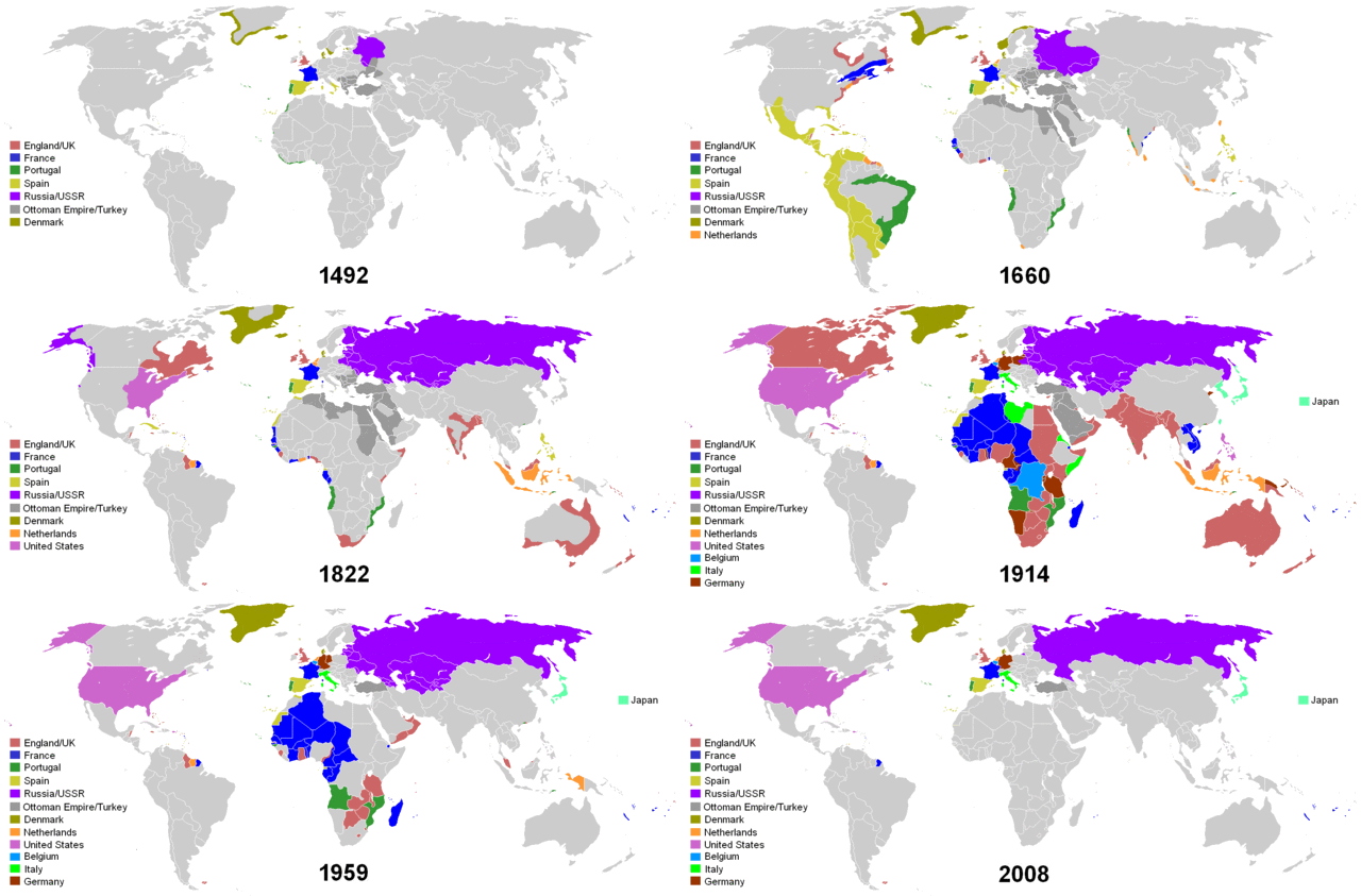
Years shown: 1492, 1550, 1660, 1754, 1822, 1885, 1914, 1938, 1959, 1974, 2008
Map indicating the territories colonized by the European powers and the United States since 1660
| Description |
English: Map indicating the territories colonized by the European powers, United States and Japan.
|
| Date |
2008-06-23 (first version); 2007-01-28 (last version) |
| Source |
Transferred from en.wikipedia |
| Author |
Original uploader was Andrei nacu at en.wikipedia Later version(s) were uploaded by Zaparojdik at en.wikipedia. |
Permission
( Reusing this file) |
Released into the public domain (by the author).
|
Licensing
| Public domainPublic domainfalsefalse |
 |
This work has been released into the public domain by its author, Andrei nacu at the wikipedia project. This applies worldwide.
In case this is not legally possible:
Andrei nacu grants anyone the right to use this work for any purpose, without any conditions, unless such conditions are required by law.
|
File usage
The following pages on Schools Wikipedia link to this image (list may be incomplete):
Wikipedia for Schools was collected by SOS Children's Villages. SOS Children is a global charity founded in 1949 to give children who have lost everything the childhood they deserve. There are many ways to help with SOS Children.


