 |
This is a file from the Wikimedia Commons. Information from its description page there is shown below.
Commons is a freely licensed media file repository. You can help.
|
| DescriptionDEM Baikal lake.png |
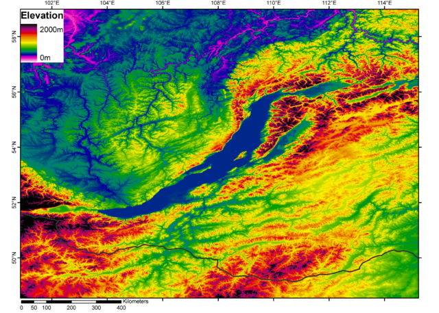
Česky: DEM Bajkalského jezera. Černá čára je Rusko-mongolská hranice.
English: Digital elevation model (DEM) of Lake Baikal. The black line is the Russia-Mongolia boundary.
|
| Date |
|
| Source |
from the GLOBE dataset ( http://www.ngdc.noaa.gov/mgg/topo/globega2.html) |
| Author |
processed with Arcgis 9.1 by Jide |
Permission
( Reusing this file) |
|
I, the copyright holder of this work, hereby publish it under the following license:
|
|
File usage
The following pages on Schools Wikipedia link to this image (list may be incomplete):
All five editions of Schools Wikipedia were compiled by SOS Children's Villages. SOS Childrens Villages helps more than 2 million people across 133 countries around the world. Have you heard about child sponsorship? Visit our web site to find out.


