 |
This is a file from the Wikimedia Commons. Information from its description page there is shown below.
Commons is a freely licensed media file repository. You can help.
|
Summary
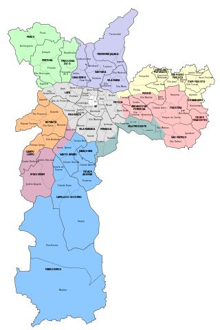
Map of the city of São Paulo, with the delimitations of districts, subprefectures and zones.
Licensing
I, the copyright holder of this work, hereby publish it under the following license:

 |
This file is licensed under the Creative Commons Attribution 3.0 Unported license. |
|
|
|
- You are free:
- to share – to copy, distribute and transmit the work
- to remix – to adapt the work
- Under the following conditions:
- attribution – You must attribute the work in the manner specified by the author or licensor (but not in any way that suggests that they endorse you or your use of the work).
http://creativecommons.org/licenses/by/3.0 CC-BY-3.0 Creative Commons Attribution 3.0 truetrue
|
|
File usage
The following pages on Schools Wikipedia link to this image (list may be incomplete):
This file contains additional information, probably added from the digital camera or scanner used to create or digitize it. If the file has been modified from its original state, some details may not fully reflect the modified file.
SOS Childrens Villages has brought Wikipedia to the classroom. SOS Children is a global charity founded in 1949 to give children who have lost everything the childhood they deserve. Help another child by taking out a sponsorship.


