
File:Bản đồ Hà Nội.png
Size of this preview: 480 × 479 pixels.
| |
This is a file from the Wikimedia Commons. Information from its description page there is shown below.
Commons is a freely licensed media file repository. You can help. |
| Description |
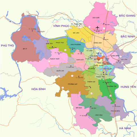
English: Map of Hanoi at the end of 2008
Tiếng Việt: Bản đồ Hà Nội cuối năm 2008
|
|||||
| Date | 15:19, ngày 30 tháng 12 năm 2008 (UTC) | |||||
| Source | vi:Tập tin:Bản đồ Hà Nội.png | |||||
| Author | Lưu Ly | |||||
| Permission ( Reusing this file) |
|
| Annotations | This image is annotated: View the annotations at Commons |
|
Camera location |
|
View this and other nearby images on: Google Maps - Google Earth - OpenStreetMap | ( Info) |
|---|
| Annotations | This image is annotated: View the annotations at Commons |
File usage
The following pages on Schools Wikipedia link to this image (list may be incomplete):
Metadata
Schools Wikipedia and SOS Children
Wikipedia for Schools is one of SOS Childrens Villages' many educational projects. SOS Childrens Villages helps more than 2 million people across 133 countries around the world. We have helped children in Africa for many years - you can help too...