 |
This is a file from the Wikimedia Commons. Information from its description page there is shown below.
Commons is a freely licensed media file repository. You can help.
|
| Description |
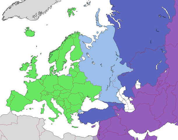
English: Map of Europe, indicating continental boundary and transcontinental states. States geographically in Europe (excepting overseas possessions; island states UK, Ireland, Iceland and Malta usually grouped with the European continent)
Transcontinental states, European territory
Transcontinental states, Asian territory
Geographically Asian states (island states of Cyprus and Bahrain usually grouped with Asia geographically)
Asian part of Egypt
|
| Date |
2011-04-08 12:11 (UTC) |
| Source |
|
| Author |
- derivative work: Dbachmann ( talk)
|
 |
This is a retouched picture, which means that it has been digitally altered from its original version. Modifications: corrections, cropped, removed labels. The original can be viewed here: Europe_subregion_map_UN_geoschme.svg. Modifications made by Dbachmann.
|
File usage
The following pages on Schools Wikipedia link to this image (list may be incomplete):
Wikipedia for Schools was collected by SOS Children's Villages. SOS Children cares for children who have lost their parents. Our Children's Villages give these children a new home and a new family, while a high-quality education and the best of medical care ensures they will grow up with all they need to succeed in adult life. There are many ways to help with SOS Children's Villages.


