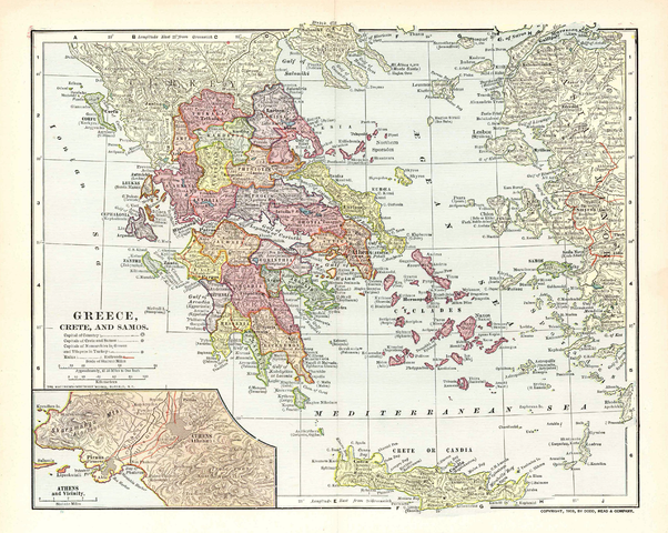
File:Map of Greece 1903.png

Summary
| Description |
Map of the Kingdom of Greece, the Cretan State and the Principality of Samos in 1903. It displays the greek railway network as it was in 1900-1901. |
|---|---|
| Source |
Old map, own collection. |
| Date |
1903 |
| Author |
Unknown. Published by Dodd, Mead & Co. Printed by Mattheus-Northup Works, Buffalo, NY. |
| Permission ( Reusing this file) |
See below.
|
Licensing
‹The template Keep local is being considered for possible deletion.›
| The uploader or another editor requests that the local copy of this file be kept. This image or media file may be available on the Wikimedia Commons as File:Map of Greece 1903.png. While the license of this work may be compliant with the Wikimedia Commons, an editor has requested that the local copy be kept too. This file does not meet CSD F8, and should not be nominated for deletion as a Commons duplicate without the permission of the tagging editor. |
|
File usage
About Schools Wikipedia
Wikipedia for Schools is one of SOS Children's Villages' many educational projects. Our 500 Children's Villages provide a home for thousands of vulnerable children. Beyond our Villages, we support communities, helping local people establish better schools and delivering effective medical care to vulnerable children. There are many ways to help with SOS Children's Villages.

