 |
This is a file from the Wikimedia Commons. Information from its description page there is shown below.
Commons is a freely licensed media file repository. You can help.
|
Summary
| Description |
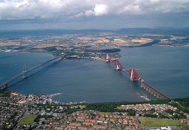
English: Aerial photograph of both bridges across the River Forth in Scotland. The Forth Road Bridge is to the left, the Forth Rail Bridge to the right.
|
| Date |
3 August 2005 |
| Source |
From geograph.org.uk; |
| Author |
Geograph.co.uk user Derek Bathgate |
Licensing
 |
This image was taken from the Geograph project collection. See this photograph's page on the Geograph website for the photographer's contact details. The copyright on this image is owned by Derek Bathgate and is licensed for reuse under the Creative Commons Attribution-ShareAlike 2.0 license. |
|
Camera location
|
55° 59′ 2.81″ N, 3° 23′ 37.40″ W
|
This and other images at their locations on: Google Maps - Google Earth - OpenStreetMap |
( Info)55.984114;-3.393723 |
 |
Permission is granted to copy, distribute and/or modify this document under the terms of the GNU Free Documentation License, Version 1.2 or any later version published by the Free Software Foundation; with no Invariant Sections, no Front-Cover Texts, and no Back-Cover Texts. A copy of the license is included in the section entitled GNU Free Documentation License. http://www.gnu.org/copyleft/fdl.htmlGFDLGNU Free Documentation Licensetruetrue
|
File usage
The following pages on Schools Wikipedia link to this image (list may be incomplete):
Schools Wikipedia was launched to make learning available to everyone. SOS Children believes that a decent childhood is essential to a happy, healthy. Our community work brings families new opportunities through education, healthcare and all manner of support. Have you thought about sponsoring a child?


