 |
This is a file from the Wikimedia Commons. Information from its description page there is shown below.
Commons is a freely licensed media file repository. You can help.
|
Summary
| Description |
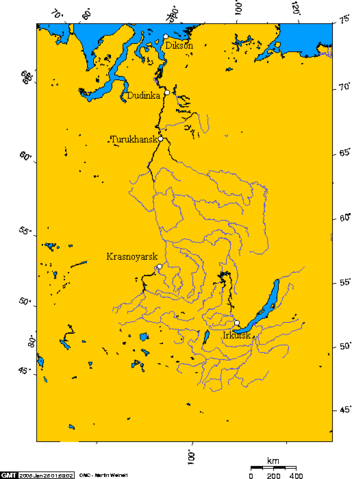
Česky: Povodí řeky Jenisej, Bajkalské jezero a města Dikson, Dudinka, Turukhansk, Krasnoyarsk, Irkutsk
English: The Yenisei basin, Lake Baikal, and the cities of Dikson, Dudinka, Turukhansk, Krasnoyarsk, Irkutsk
I fed the following latitude and longitude to the map generation tool to spot the location of the cities:
- 80.7111,73.5333, Dikson
- 86.2383,69.4438, Dudinka
- 87.9624,65.7959, Turukhansk
- 92.9756,56.0103, Krasnoyarsk
- 104.248,52.3174, Irkutsk
|
| Date |
first upload 02:32, 25 January 2005 |
| Source |
- first upload en.wikipedia
|
| Author |
first upload Geo Swan (28720 bytes) |
Permission
( Reusing this file) |
| Public domainPublic domainfalsefalse |
 |
I, the copyright holder of this work, release this work into the public domain. This applies worldwide.
In some countries this may not be legally possible; if so:
I grant anyone the right to use this work for any purpose, without any conditions, unless such conditions are required by law.Public domainPublic domainfalsefalse
|
 |
Permission is granted to copy, distribute and/or modify this document under the terms of the GNU Free Documentation License, Version 1.2 or any later version published by the Free Software Foundation; with no Invariant Sections, no Front-Cover Texts, and no Back-Cover Texts. A copy of the license is included in the section entitled GNU Free Documentation License. http://www.gnu.org/copyleft/fdl.htmlGFDLGNU Free Documentation Licensetruetrue
|
|
See also
File usage
The following pages on Schools Wikipedia link to this image (list may be incomplete):
SOS Childrens Villages chose the best bits of Wikipedia to help you learn. Thanks to SOS Children's Villages, 62,000 children are enjoying a happy childhood, with a healthy, prosperous future ahead of them. There are many ways to help with SOS Children.


