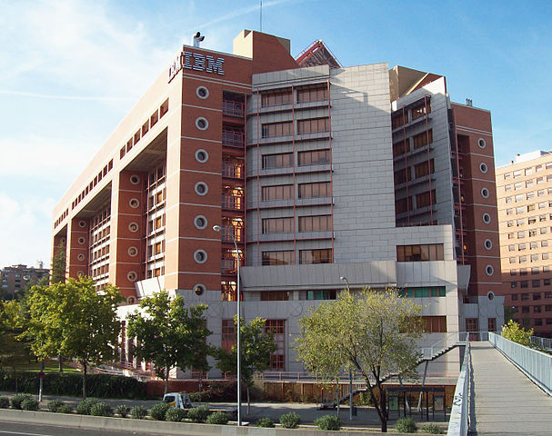
File:IBM building in Madrid (1989) 01.jpg

Size of this preview: 607 × 480 pixels.
| |
This is a file from the Wikimedia Commons. Information from its description page there is shown below.
Commons is a freely licensed media file repository. You can help. |
| DescriptionIBM building in Madrid (1989) 01.jpg |
English: View of IBM building in Madrid ( Spain) from the south-east angle ( Avenida de América, avenue). Address: 26-28 Calle de Santa Hortensia (street) in Chamartín district. It was projected by architects Salvador Gayarre, Tomás Domínguez del Castillo and Juan Martín Baranda, and built from 1987 to 1989.
Español: Vista del edificio de IBM en Madrid ( España) desde el ángulo sureste ( Avenida de América). Dirección: nº 26-28 de la Calle de Santa Hortensia, en el distrito de Chamartín. Fue proyectado por los arquitectos Salvador Gayarre, Tomás Domínguez del Castillo y Juan Martín Baranda, y construido de 1987 a 1989.
|
||||||||
| Date | 27 October 2009 | ||||||||
| Source | Own work | ||||||||
| Author | Luis García ( Zaqarbal) | ||||||||
| Permission ( Reusing this file) |
|
|
Object location |
40° 26′ 36.83″ N, 3° 39′ 58.20″ W |
View this and other nearby images on: Google Maps - Google Earth - OpenStreetMap - Proximityrama | ( Info)40.443563;-3.666167 |
|---|
File usage
The following pages on Schools Wikipedia link to this image (list may be incomplete):
Metadata
This file contains additional information, probably added from the digital camera or scanner used to create or digitize it. If the file has been modified from its original state, some details may not fully reflect the modified file.
| Image title | IBM building in Madrid (Spain), from 1989. |
|---|---|
| Camera manufacturer | EASTMAN KODAK COMPANY |
| Camera model | KODAK EASYSHARE C713 ZOOM DIGITAL CAMERA |
| Author | Luis Garcia ( Zaqarbal) |
| Copyright holder | Luis Garcia ( Zaqarbal) publishes this photo in Wikimedia Commons under GFDL and Cc-by-sa-3.0,2.5,2.0,1.0 licenses. |
| Exposure time | 1,029/250,000 sec (0.004116) |
| F-number | f/4.8 |
| ISO speed rating | 80 |
| Date and time of data generation | 15:59, 27 October 2009 |
| Lens focal length | 6 mm |
| Orientation | Normal |
| Horizontal resolution | 0 dpc |
| Vertical resolution | 0 dpc |
| Software used | Adobe Photoshop 7.0 |
| File change date and time | 02:46, 7 November 2009 |
| Y and C positioning | Co-sited |
| Exposure Program | Normal program |
| Exif version | 2.21 |
| Date and time of digitizing | 15:59, 27 October 2009 |
| Shutter speed | 7.92 |
| APEX aperture | 4.52 |
| Maximum land aperture | 2.86 APEX (f/2.69) |
| Metering mode | Pattern |
| Light source | Unknown |
| Flash | Flash did not fire, compulsory flash suppression |
| Colour space | sRGB |
| Exposure index | 80 |
| Sensing method | One-chip colour area sensor |
| Custom image processing | Normal process |
| Exposure mode | Auto exposure |
| White balance | Auto white balance |
| Digital zoom ratio | 0 |
| Focal length in 35 mm film | 36 mm |
| Scene capture type | Standard |
| Contrast | Normal |
| Saturation | Normal |
| Sharpness | Normal |
| Subject distance range | Unknown |
What is Schools Wikipedia?
Schools Wikipedia was launched to make learning available to everyone. SOS Children helps more than 2 million people across 133 countries around the world. You can help by sponsoring a child.

