
File:Donau-Wien-UNOcity.jpg
| |
This is a file from the Wikimedia Commons. Information from its description page there is shown below.
Commons is a freely licensed media file repository. You can help. |
Summary
| Description |
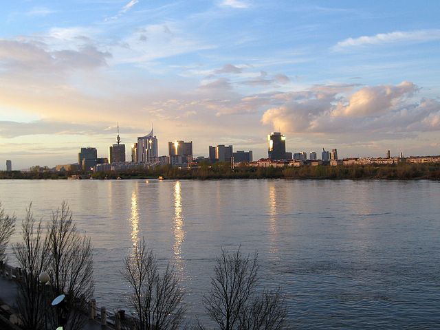
Deutsch: Österreich, Wien, Vienna International Centre
English: Austria, Vienna, Vienna International Centre
Русский: Австрия, Вена, Венский международный центр
Français : Autriche, Vienne, Vienna International Centre
Donau-Hauptstrom in Wien, im Hintergrund der rund um das Vienna International Centre (Teil der UNO-City) entstehende neue Stadtteil Donau City mit einer für hier ungewöhnlichen Ansammlung von Hochhäusern links im Bild überragt vom weiter im Hintergrund befindlichen Donauturm, alle im 22. Bezirk = Donaustadt; Hochhaus am linken Bildrand: Florido Tower, 21. Bezirk = Floridsdorf (Blickrichtung etwa von Süden nach Norden) Danube river within the town boundaries of Vienna, the background showing the new quarter Donau City with a here rather unusual concentration of high-rises - emerging around the Vienna International Centre as part of the UNO-City - on the left surmounted by furtherly standing Donauturm, all in the 22nd district = Donaustadt; high rise close to left image border: Florido Tower, 21st district = Floridsdorf (looking roughly from S to N) |
| Date | 23 April 2006 |
| Source | Own work |
| Author | Omnidoom 999 |
Licensing
|

|
Camera location |
|
View this and other nearby images on: Google Maps - Google Earth - OpenStreetMap | ( Info) |
|---|
File usage
Metadata
A background to Schools Wikipedia
Schools Wikipedia was created by children's charity SOS Children. SOS Childrens Villages helps more than 2 million people across 133 countries around the world. There are many ways to help with SOS Childrens Villages.