
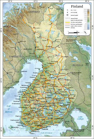
File:Map of Finland-en.svg
Size of this preview: 327 × 479 pixels.
| |
This is a file from the Wikimedia Commons. Information from its description page there is shown below.
Commons is a freely licensed media file repository. You can help. |
|
|
This vector image was created with Inkscape. |
Summary
| Description |
English: Map of Finland.
Suomi: Suomen kartta.
Svenska: Karta över Finland.
|
| Date | 5 March 2009 |
| Source | Self-made in Inkscape.
|
| Author | Oona Räisänen ( Mysid) |
| Permission ( Reusing this file) |
See below. I've worked hard to create this map, so even though not mandatory, please attribute me wherever it is suitable. |
| |
This SVG file uses embedded text that can be easily translated into your language using this automated tool. Learn more. You can also download it and translate it manually using a text editor.
|
Licensing
 |
I, the copyright holder of this work, release this work into the public domain. This applies worldwide. In some countries this may not be legally possible; if so: I grant anyone the right to use this work for any purpose, without any conditions, unless such conditions are required by law.
|
File usage
The following pages on Schools Wikipedia link to this image (list may be incomplete):
Metadata
More information
Schools Wikipedia has been carefully checked to give you the best learning experience. SOS Childrens Villages works in 133 countries and territories across the globe, helps more than 62,000 children, and reaches over 2 million people in total. Would you like to sponsor a child?