
File:Satellite image of Denmark in July 2001.jpg
Size of this preview: 640 × 477 pixels.
| |
This is a file from the Wikimedia Commons. Information from its description page there is shown below.
Commons is a freely licensed media file repository. You can help. |
 |
This file is in the public domain because it was solely created by NASA. NASA copyright policy states that "NASA material is not protected by copyright unless noted". (See Template:PD-USGov, NASA copyright policy page or JPL Image Use Policy.) |
 |
 |
Warnings:
|
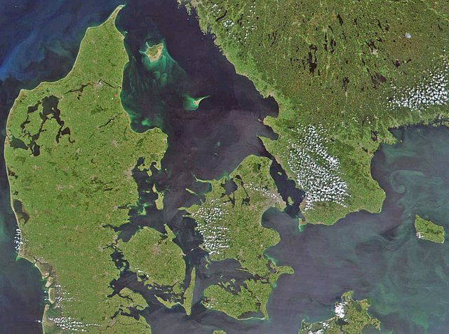
Satellite image of Denmark in July 2001. Cropped image, original taken from NASA's Visible Earth http://visibleearth.nasa.gov/view_rec.php?id=1909
- Interestingly, the Danish-German border is incorrectly placed. The line shown on the map has the correct shape, but is located c. 10 kilometres south of the current border. The line should have been positioned between the islands Rømø and Sylt in the west, and through the fjord to the east. Valentinian (talk) 17:09, 12 November 2006 (UTC)
File usage
The following pages on Schools Wikipedia link to this image (list may be incomplete):
Did you know...?
All five editions of Schools Wikipedia were compiled by SOS Children's Villages. By supporting vulnerable children right through to adulthood, SOS Children's Villages makes a lasting difference to the lives of thousands of people. Education is a key part of our work, and our schools provide high-quality teaching to the children in our care. Will you help another child today?