 |
This is a file from the Wikimedia Commons. Information from its description page there is shown below.
Commons is a freely licensed media file repository. You can help.
|
| Description |
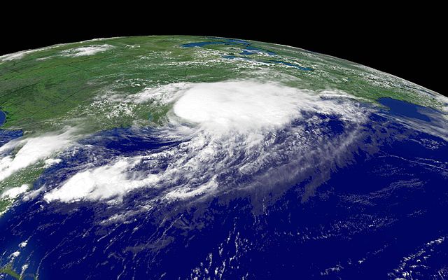
The angled image of en:Hurricane Charley was taken by a en:National Oceanic and Atmospheric Administration satellite at 12:45 p.m. EDT on en:August 14, en:2004. As seen above, the storm came ashore in the en:United States three times: over en:Florida and twice over en:South Carolina, near the SC/NC border, which is seen here. |
| Date |
|
| Source |
http://www.noaanews.noaa.gov/stories2004/images/charley081404c-1645z2.jpg |
| Author |
User Neutrality on en.wikipedia |
Permission
( Reusing this file) |
| Public domainPublic domainfalsefalse |
 |
This image is in the public domain because it contains materials that originally came from the U.S. National Oceanic and Atmospheric Administration, taken or made as part of an employee's official duties.
|
|
|
File usage
The following pages on Schools Wikipedia link to this image (list may be incomplete):
SOS Children's Villages has brought Wikipedia to the classroom. SOS Children is a global charity founded in 1949 to give children who have lost everything the childhood they deserve. There are many ways to help with SOS Childrens Villages.


