
File:Holkham Hall estatemap1946.png
Size of this preview: 438 × 480 pixels.
| |
This is a file from the Wikimedia Commons. Information from its description page there is shown below.
Commons is a freely licensed media file repository. You can help. |
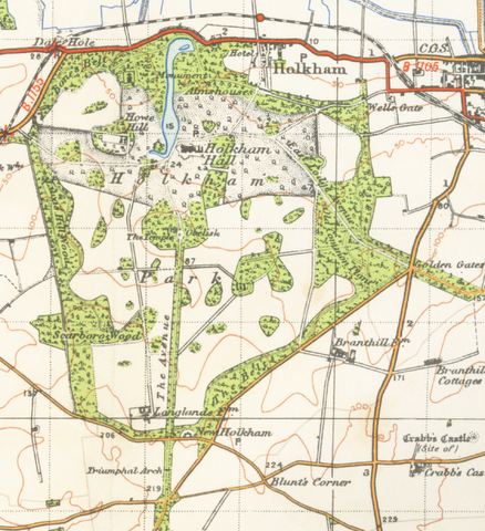
| Description | Map of Holkham Hall estate from 1946. Scale 1 inch to the mile 600DPI Sheet 125 |
| Date | 1946 |
| Source | OS |
| Author | OS |
| Permission ( Reusing this file) |
none needed |
 |
This work is in the public domain worldwide because it is an Ordnance Survey map over 50 years old. Ordnance Survey maps are covered by Crown Copyright which in this case expires 50 years after publication. Ordnance Survey does however ask that they be credited and that the date of publication be given. Any ancillary rights gained through the creation of the electronic version are granted as freely usable under any circumstances. |
File usage
The following pages on Schools Wikipedia link to this image (list may be incomplete):
A background to Schools Wikipedia
SOS Children's Villages aims to make Wikipedia suitable for young learners. Thanks to SOS Childrens Villages, 62,000 children are enjoying a happy childhood, with a healthy, prosperous future ahead of them. Will you help another child today?