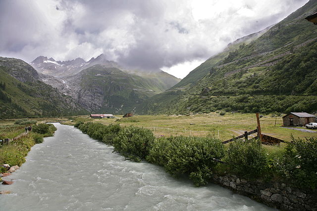
File:CH Rhone upper reaches 1-bs.jpg
- File
- File usage
- Metadata
- I want to learn more...

Size of this preview: 640 × 427 pixels.
| |
This is a file from the Wikimedia Commons. Information from its description page there is shown below.
Commons is a freely licensed media file repository. You can help. |
|
Camera location |
46° 33′ 44.54″ N, 8° 21′ 45.33″ E |
This and other images at their locations on: Google Maps - Google Earth - OpenStreetMap | ( Info)46.562371944444;8.3625911111111 |
|---|
| Description |
English: Upper reaches of the Rhone river, Rhone glacier and Furka mountain pass in the background.
Deutsch: Oberlauf der Rhone, Rhonegletscher und Furkapass-Rampe im Hintergrund
|
| Date | 30 July 2007 |
| Source | Own work |
| Author | Daniel Schwen |
| Permission ( Reusing this file) |
See license |
Licensing
|
Metadata
This file contains additional information, probably added from the digital camera or scanner used to create or digitize it. If the file has been modified from its original state, some details may not fully reflect the modified file.
| Orientation | Normal |
|---|---|
| Software used | ACD Systems Digital Imaging |
| File change date and time | 20:20, 21 August 2007 |
| Y and C positioning | Centered |
| Exif version | 2.2 |
| DateTime subseconds | 812 |
I want to learn more...
SOS Childrens Villages has brought Wikipedia to the classroom. In 133 nations around the world, SOS Children works to bring better education and healthcare to families in desperate need of support. Why not try to learn more about child sponsorship?

