
File:Carte de la Manche.png
Size of this preview: 640 × 358 pixels.
| |
This is a file from the Wikimedia Commons. Information from its description page there is shown below.
Commons is a freely licensed media file repository. You can help. |
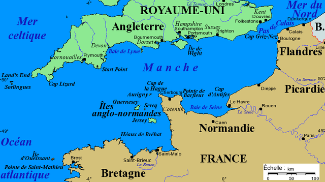
Français : Carte de la Manche avec la situation des caps principaux, des îles et des villes importantes. Projection de Mercator, données de 2005.
English: Channel map with main capes, islands and cities. Projection of Mercator, data as of 2005.
- Source : Fond de carte provenant de www.aquarius.geomar.de.
 |
Permission is granted to copy, distribute and/or modify this document under the terms of the GNU Free Documentation License, Version 1.2 or any later version published by the Free Software Foundation; with no Invariant Sections, no Front-Cover Texts, and no Back-Cover Texts. A copy of the license is included in the section entitled GNU Free Documentation License.
|
| This file is licensed under the Creative Commons Attribution-Share Alike 3.0 Unported license. | ||
|
||
| This licensing tag was added to this file as part of the GFDL licensing update.
|
Copyright © 2005-06-04 Bra
File usage
The following pages on Schools Wikipedia link to this image (list may be incomplete):
A background to Schools Wikipedia
Schools Wikipedia was created by children's charity SOS Children's Villages. Thanks to SOS Childrens Villages, 62,000 children are enjoying a happy childhood, with a healthy, prosperous future ahead of them. You can help by sponsoring a child.