
File:Eritrea Topography.png
Size of this preview: 594 × 480 pixels.
| |
This is a file from the Wikimedia Commons. Information from its description page there is shown below.
Commons is a freely licensed media file repository. You can help. |
Summary
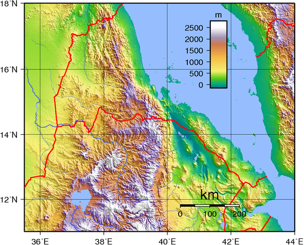
| Description | Topographic map of Eritrea. Created with GMT from public domain GLOBE data. |
| Date | 24 June 2007 |
| Source | Own work |
| Author | Sadalmelik |
Licensing
 |
This work has been released into the public domain by its author, I, Sadalmelik. This applies worldwide. In some countries this may not be legally possible; if so: I, Sadalmelik grants anyone the right to use this work for any purpose, without any conditions, unless such conditions are required by law.
|
File usage
The following pages on Schools Wikipedia link to this image (list may be incomplete):
Learn more
Wikipedia for Schools was collected by SOS Children. SOS Childrens Villages believes education is an important part of a child's life. That's why we ensure they receive nursery care as well as high-quality primary and secondary education. When they leave school, we support the children in our care as they progress to vocational training or higher education. Have you thought about sponsoring a child?