
File:Political Regions of Sudan - July 2006.svg
- File
- File usage
- Metadata
- Schools Wikipedia facts
Size of this preview: 409 × 480 pixels.
| |
This is a file from the Wikimedia Commons. Information from its description page there is shown below.
Commons is a freely licensed media file repository. You can help. |
| Description |
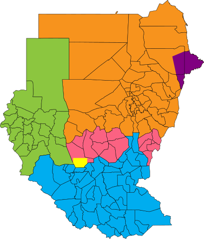
English: Map showing political regions of Sudan as of July 2006.
Darfur
Nuba Mountains and Blue Nile
North Sudan
South Sudan
Eastern Front, area of operations July 2006
Abyei, as defined by the Permanent Court of Arbitration
|
|||||
| Date | 26 May 2008 | |||||
| Source |
|
|||||
| Author | Lokal_Profil | |||||
| Permission ( Reusing this file) |
|
Metadata
Schools Wikipedia facts
All five editions of Schools Wikipedia were compiled by SOS Children's Villages. By supporting vulnerable children right through to adulthood, SOS Childrens Villages makes a lasting difference to the lives of thousands of people. Education is a key part of our work, and our schools provide high-quality teaching to the children in our care. There are many ways to help with SOS Children.