 |
This is a file from the Wikimedia Commons. Information from its description page there is shown below.
Commons is a freely licensed media file repository. You can help.
|
Summary
| Description |
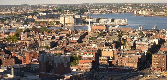
English: Image of the North End, Boston neighbourhood. The Old North Church is at centre, a Big Dig vent building is near the bottom, and the green Tobin Bridge over the Mystic River (between Charlestown and Chelsea) is at the top. The confluence of the Charles and Mystic Rivers where they empty into Boston Harbour is also visible.
 |
This is an image of a place or building that is listed on the National Register of Historic Places in the United States. Its reference number is 66000776.
|
|
| Date |
before 27 October 2004 (original upload date)
|
Object location
|
42° 21′ 58.00″ N, 71° 3′ 18.00″ W
|
This and other images at their locations on: Google Maps - Google Earth - OpenStreetMap - Proximityrama |
( Info)42.366111;-71.055 |
|
| Source |
Copied from :en:Image:North End, Boston.jpg. |
| Author |
Originally uploaded by Sfoskett. That may be the author. No other author was mentioned. |
Permission
( Reusing this file) |
 |
Permission is granted to copy, distribute and/or modify this document under the terms of the GNU Free Documentation License, Version 1.2 or any later version published by the Free Software Foundation; with no Invariant Sections, no Front-Cover Texts, and no Back-Cover Texts. A copy of the license is included in the section entitled GNU Free Documentation License. http://www.gnu.org/copyleft/fdl.htmlGFDLGNU Free Documentation Licensetruetrue
|
|
File usage
The following pages on Schools Wikipedia link to this image (list may be incomplete):
Wikipedia for Schools was collected by SOS Children. By supporting vulnerable children right through to adulthood, SOS Children makes a lasting difference to the lives of thousands of people. Education is a key part of our work, and our schools provide high-quality teaching to the children in our care. Have you heard about child sponsorship? Visit our web site to find out.


