 |
This is a file from the Wikimedia Commons. Information from its description page there is shown below.
Commons is a freely licensed media file repository. You can help.
|
| Description |
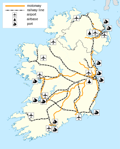
English: The island of Ireland, showing international border between Northern Ireland and Republic of Ireland, traditional provinces, traditional counties, and local authority areas in the Republic of Ireland and Northern Ireland.
|
| Date |
2010-03-29 20:53 (UTC) |
| Source |
|
| Author |
- derivative work: Rannpháirtí anaithnid ( talk)
- derivative work: Rannpháirtí anaithnid ( talk)
|
 |
This is a retouched picture, which means that it has been digitally altered from its original version. Modifications: Added locations of transport features. The original can be viewed here: Island_of_Ireland_location_map.svg. Modifications made by Rannpháirtí anaithnid.
|
|
I, the copyright holder of this work, hereby publish it under the following license:
|
This file contains additional information, probably added from the digital camera or scanner used to create or digitize it. If the file has been modified from its original state, some details may not fully reflect the modified file.
SOS Childrens Villages aims to make Wikipedia suitable for young learners. Our 500 Children's Villages provide a home for thousands of vulnerable children. Beyond our Villages, we support communities, helping local people establish better schools and delivering effective medical care to vulnerable children. There are many ways to help with SOS Children's Villages.


