Geography of Niger
Did you know...
The articles in this Schools selection have been arranged by curriculum topic thanks to SOS Children volunteers. SOS mothers each look after a a family of sponsored children.
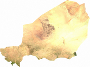
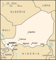
Niger is a landlocked nation in West Africa located along the border between the Sahara and Sub-Saharan regions. Its geographic coordinates are a longitude of 16°N and a latitude off 8°E. Its area is 1.267 million square kilometers, of which 1 266 700 km² is land and 300 km² water. This makes Niger slightly less than twice the size of the U.S. state of Texas.
Political geography
Niger borders seven countries and has a total of 5 697 km of borders. The longest border is Nigeria to the south, at 1 497 km. This is followed by Chad to the east (1 175 km), Algeria to the northnorthwest (956 km), and Mali at 821 km. Niger also has short borders in its far southwest frontier (Burkina Faso at 628 km and Benin at 266 km) and to the northnortheast (Libya at 354 km).
Physical geography
Climate
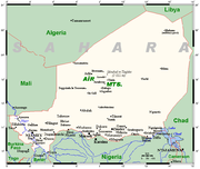
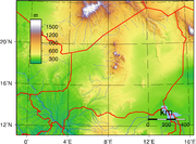
Niger's climate is mainly hot and dry, with much desert area. In the extreme south there is a tropical climate on the edges of the Niger River Basin. The terrain is predominantly desert plains and sand dunes, with flat to rolling plains in the south and hills in the north. Lake Chad is at the south-east corner of the country and is shared between Niger, Nigeria, Chad and Cameroon.
Extreme points
- Northernmost Point: Tripoint with Algeria and Libya, Agadez Region: 23°31'N
- Southernmost Point: Benin/Niger/Nigeria tripoint, Dosso Region: 11°42'N
- Easternmost Point: border with Chad, Agadez Region: 16°00'E
- Westernmost Point: border with Mali and Burkina Faso, Tillaberi Region: 0°07'E
- Highest Point: Mont Idoukal-n-Taghès, Air Massif, Agadez Region:2,022 m (6,634 ft)
- Lowest Point: Niger River at Nigeria border, Dosso Region: 200 m (656 ft)
Agricultural geography
Land in Niger is used as arable land (660 km² of land in Niger is irrigated), and as pasture. There are some forests and woodland. The table below describes the land us in Niger, as of 1993.
| Use | Percentage of Area |
|---|---|
| arable land | 3 |
| permanent pastures | 7 |
| forests and woodland | 2 |
| other | 88 |
Environment
Natural hazards
Recurring droughts are a hazard in Niger.
Current issues
Current environmental issues in Niger include: overgrazing, soil erosion, deforestation, desertification and endangered wildlife populations (such as elephant, hippopotamus, giraffe, and lion), which are threatened because of poaching and habitat destruction.
International agreements
Niger is a party to the following agreements:
- Biodiversity
- Climate Change
- Desertification
- Endangered Species
- Environmental Modification
- Hazardous Wastes
- Nuclear Test Ban
- Ozone Layer Protection
- Wetlands
Niger has signed, but not ratified the Kyoto Protocol and Law of the Sea.


